I may earn commissions for affiliate purchases.
Yosemite trail maps
If you’re doing Yosemite just by car, the free maps below will be sufficient. If you’re doing a lot of hiking or any overnight trip, you’ll want to purchase a detailed trail map, such as the National Geographic Trails Illustrated map or the fantastic Tom Harrison map. Neither of these maps is detailed enough for off-trail travel, so you’ll want the large-scale Trails Illustrated four-pack bundle if you’re heading cross-country.
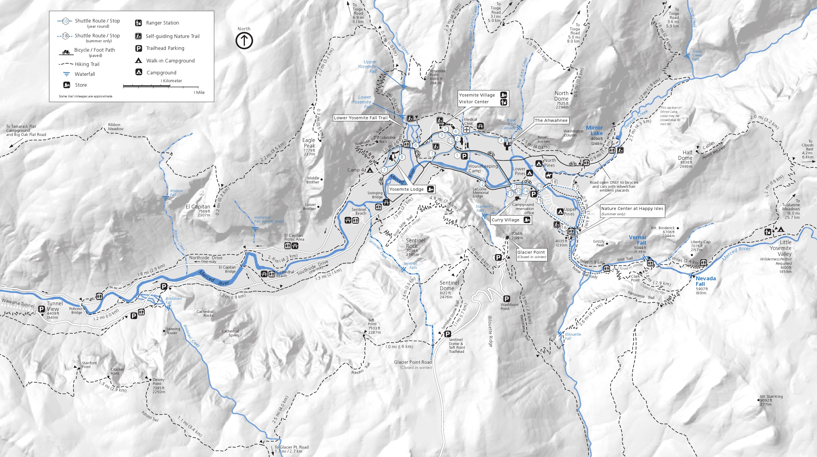 This is the Yosemite Valley trail map (700 kb), showing the popular Yosemite Valley hikes including Yosemite Falls, Half Dome, Vernal Fall, Nevada Fall, Mirror Lake, Valley Loop, and Bridalveil Fall.
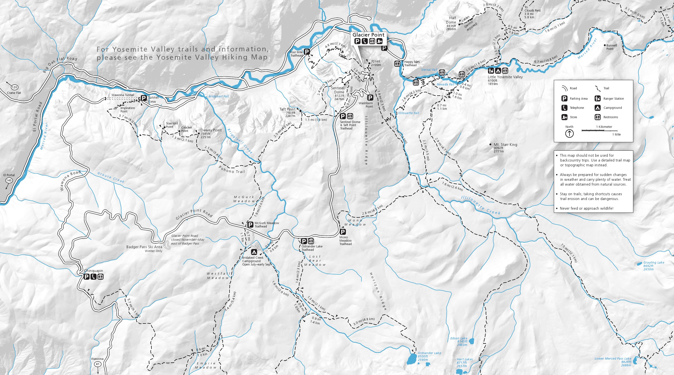 This is the Glacier Point area trail map (750 kb), showing Glacier Point Road area hiking trails including Sentinel Dome, Taft Point, Dewey Point, and Ostrander Lake. (Sentinel Dome and Taft Point are my favorites.)
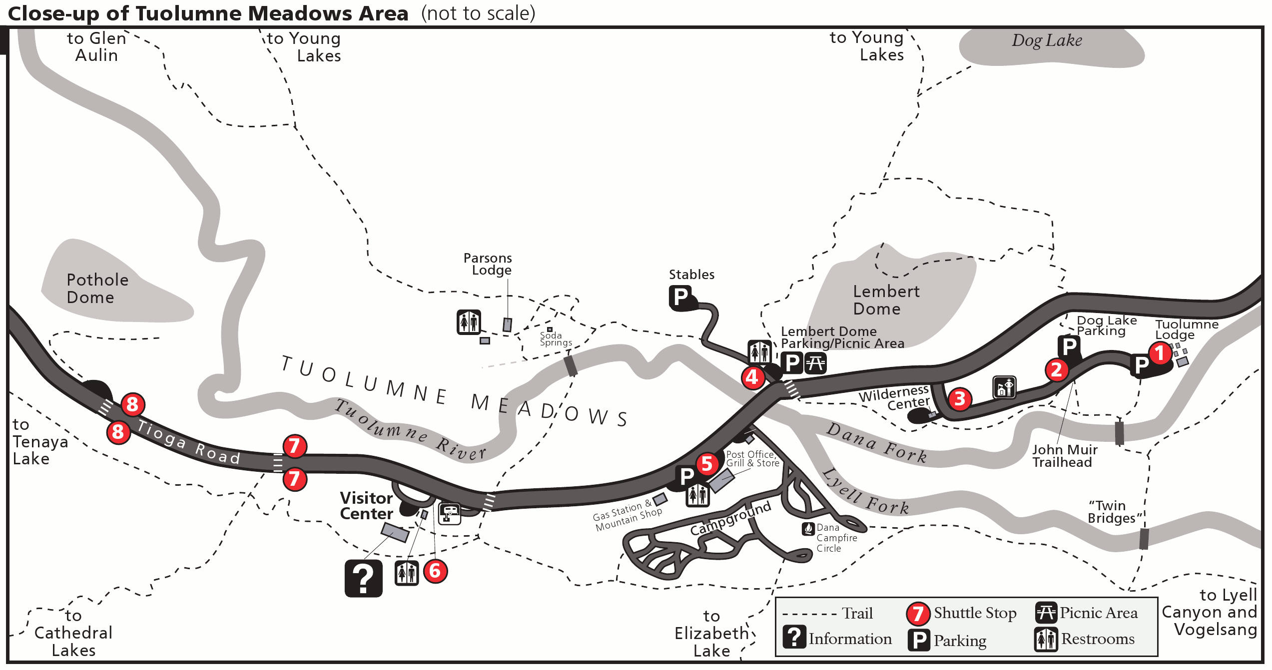 This is the Tuolumne Meadows trail map (200 kb), which includes shuttle bus stops, Lembert Dome, and Soda Springs. Please note that this map isn’t to scale, as the two maps above are.
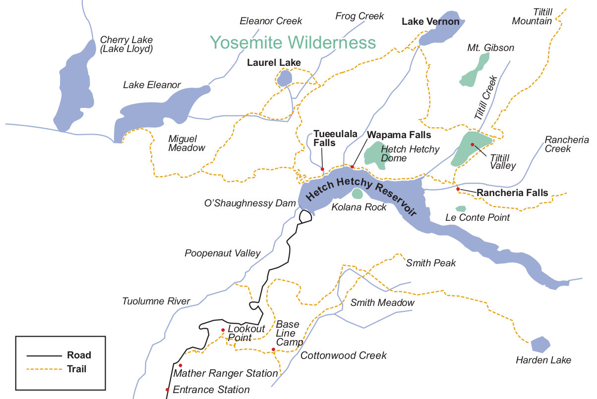 Here’s a Hetch Hetchy trail map (120 kb), which shows the main trails to the various waterfalls (Wapama, Rancheria), lakes, and peaks. The trail along the reservoir is mostly flat – the others involve more elevation.
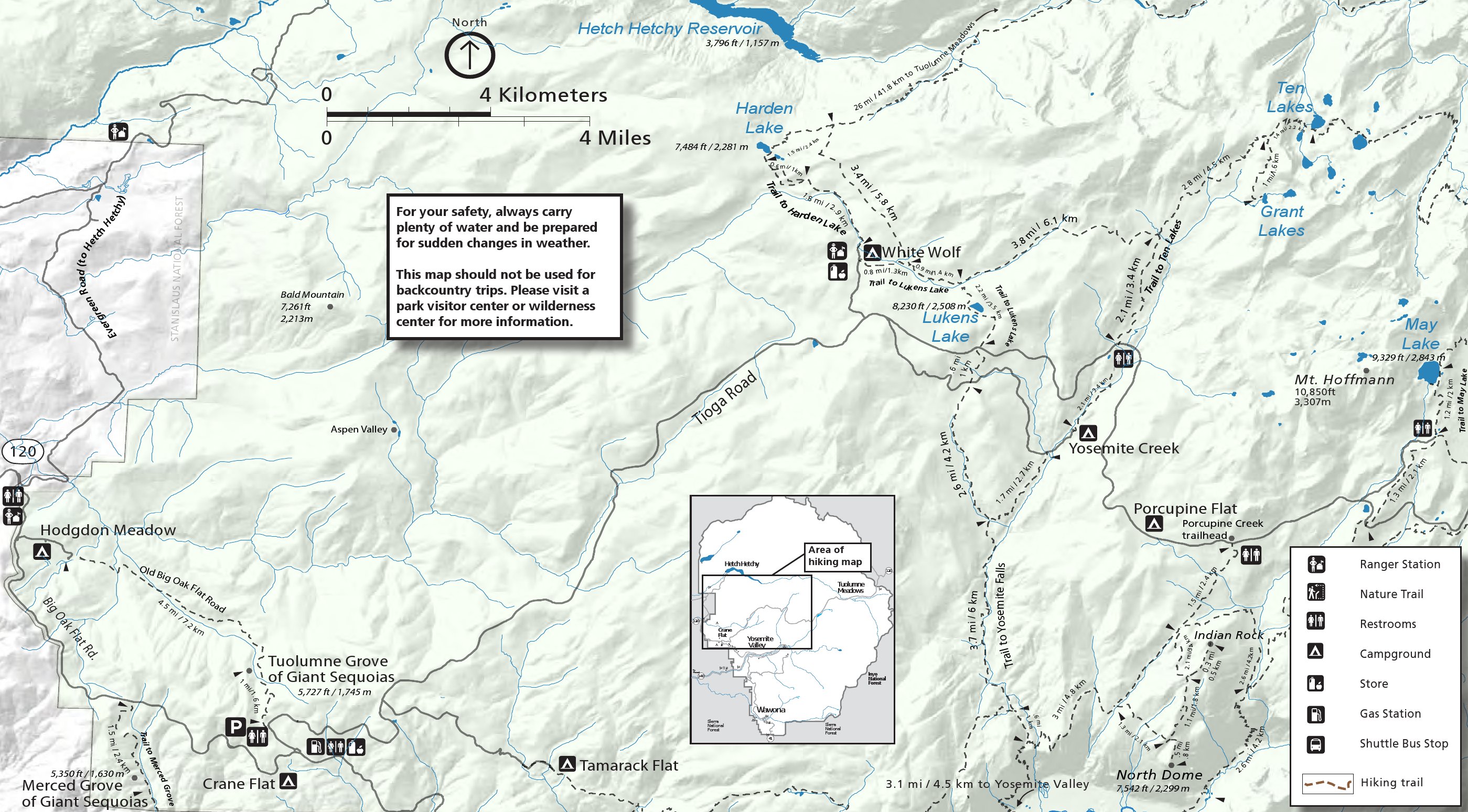 This Crane Flat/White Wolf trail map (800 kb) features hikes off western Tioga Road including North Dome, Tuolumne Grove, Harden Lake, May Lake, and Lukens Lake. Of these, North Dome is my favorite.
 Here’s a Wawona trail map (700 kb), including the trails in the Wawona area such as Chilnualna Falls, Meadow Loop, and the Mariposa Grove. The map below zooms in on the grove with much more detail.
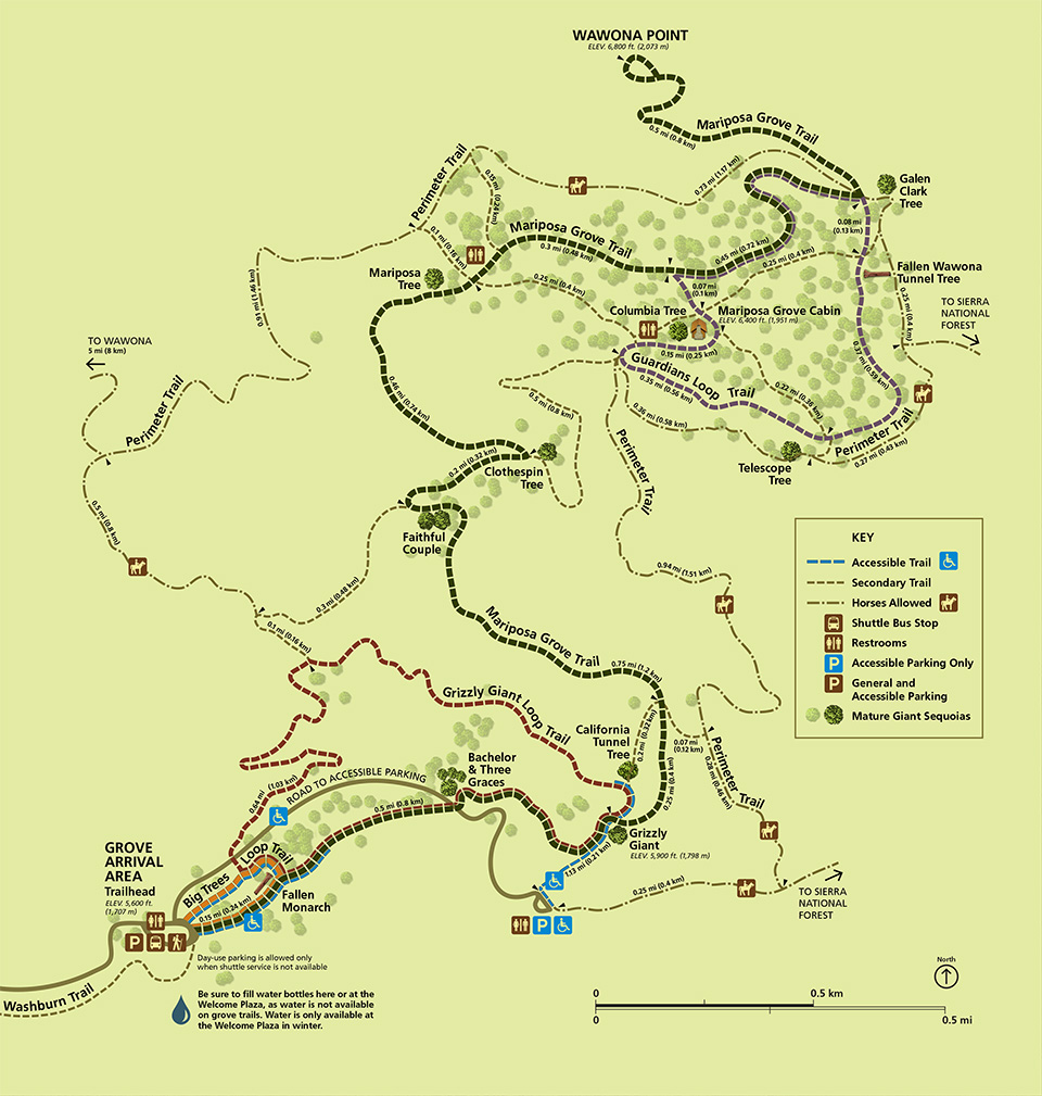 Here’s a Mariposa Grove trail map (300 kb), showing trails to the Grizzly Giant, California Tunnel Tree, and more. This map was updated in June 2018 to reflect the new layout of the trails through the sequoias.
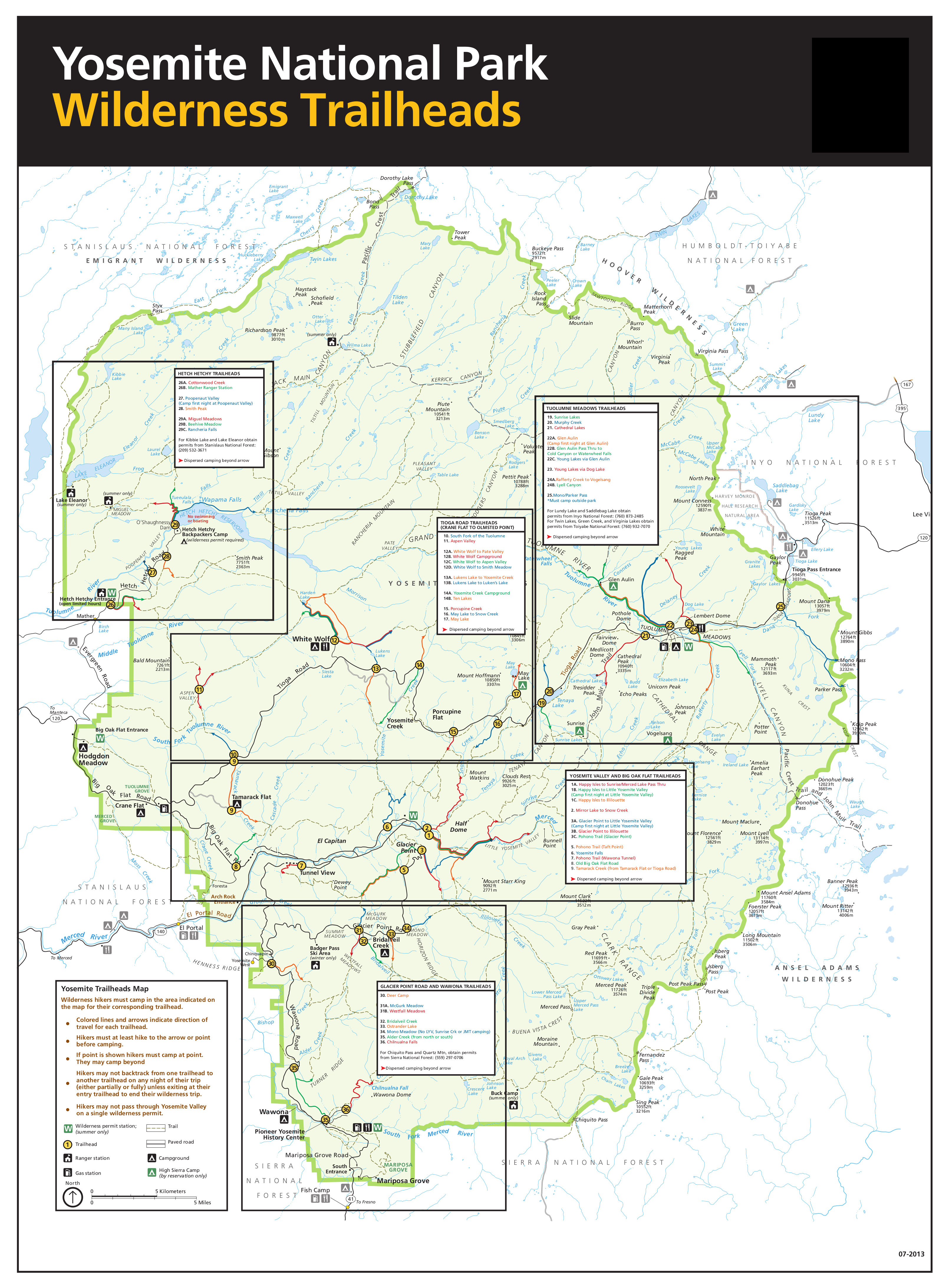 This is the Yosemite wilderness trailhead map (2.2 mb), labeling all the trails that are reservable for an overnight wilderness permit (walk-in permits are also available). Get your permit early.
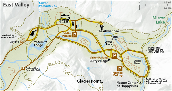
Various Yosemite Valley maps
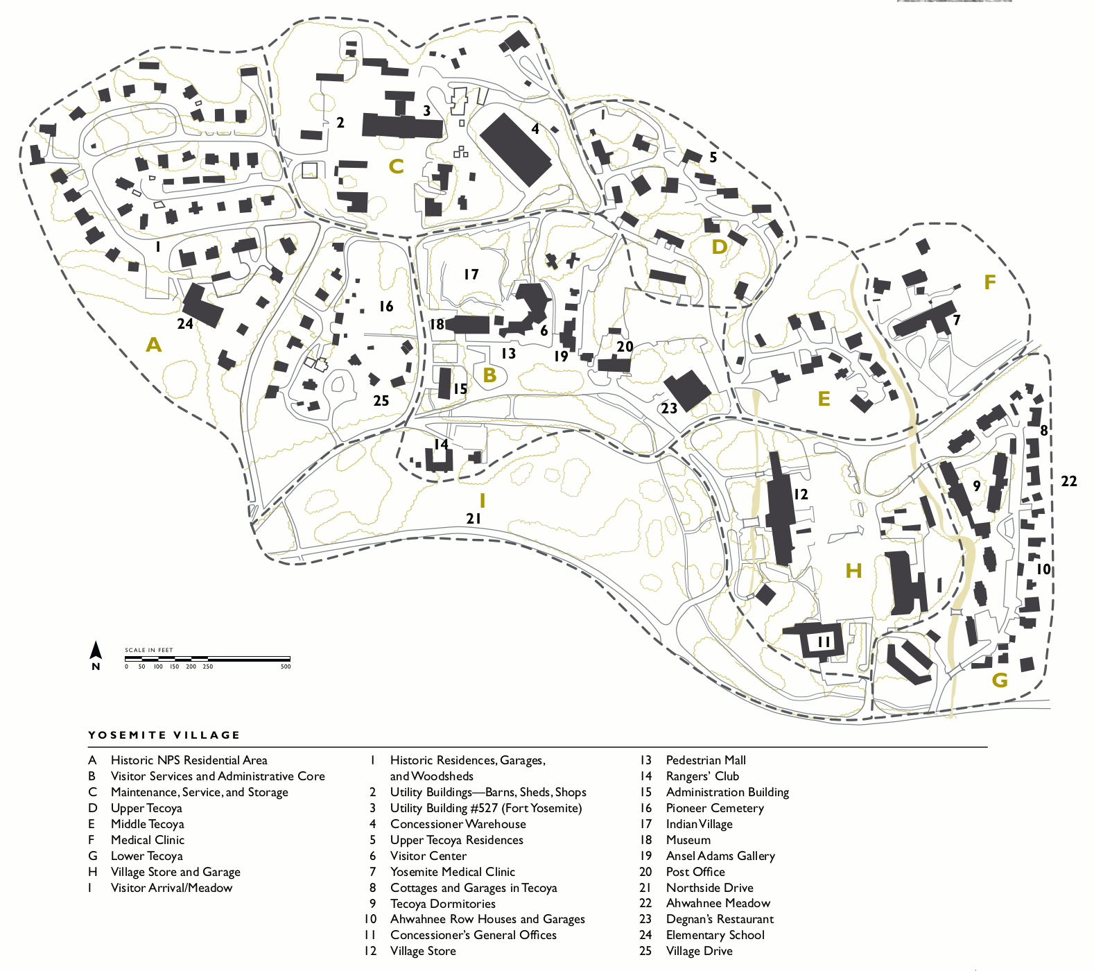 Here’s a Yosemite Village map (300 kb), showing the main developed area of Yosemite Valley that includes the visitor center, post office, wilderness center, Ansel Adams Gallery, village store, and housing.
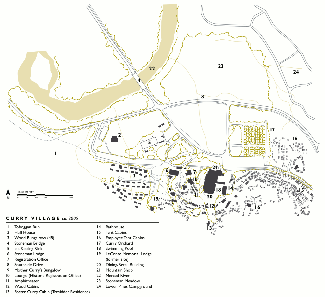 This Curry Village map (200 kb) reveals the complex, chaotic nature of the Curry Village (aka “Half Dome Village”) area. You WILL probably get lost, but that’s OK – that’s really the best way to learn.
 The Yosemite Lodge map (130 kb) shows the mid-range lodging option in Yosemite Valley – a step up from Curry Village but not the luxury prices of the Ahwahnee. This is your closest lodging option to Yosemite Falls.
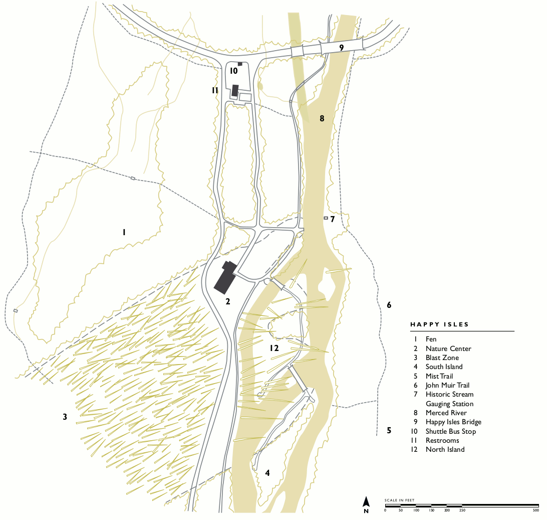 This Happy Isles map (150 kb) includes the Happy Isles Nature Center and the main trails along the Merced River, including the beginning of the Mist Trail and John Muir Trail. Enjoy the lack of cars here!
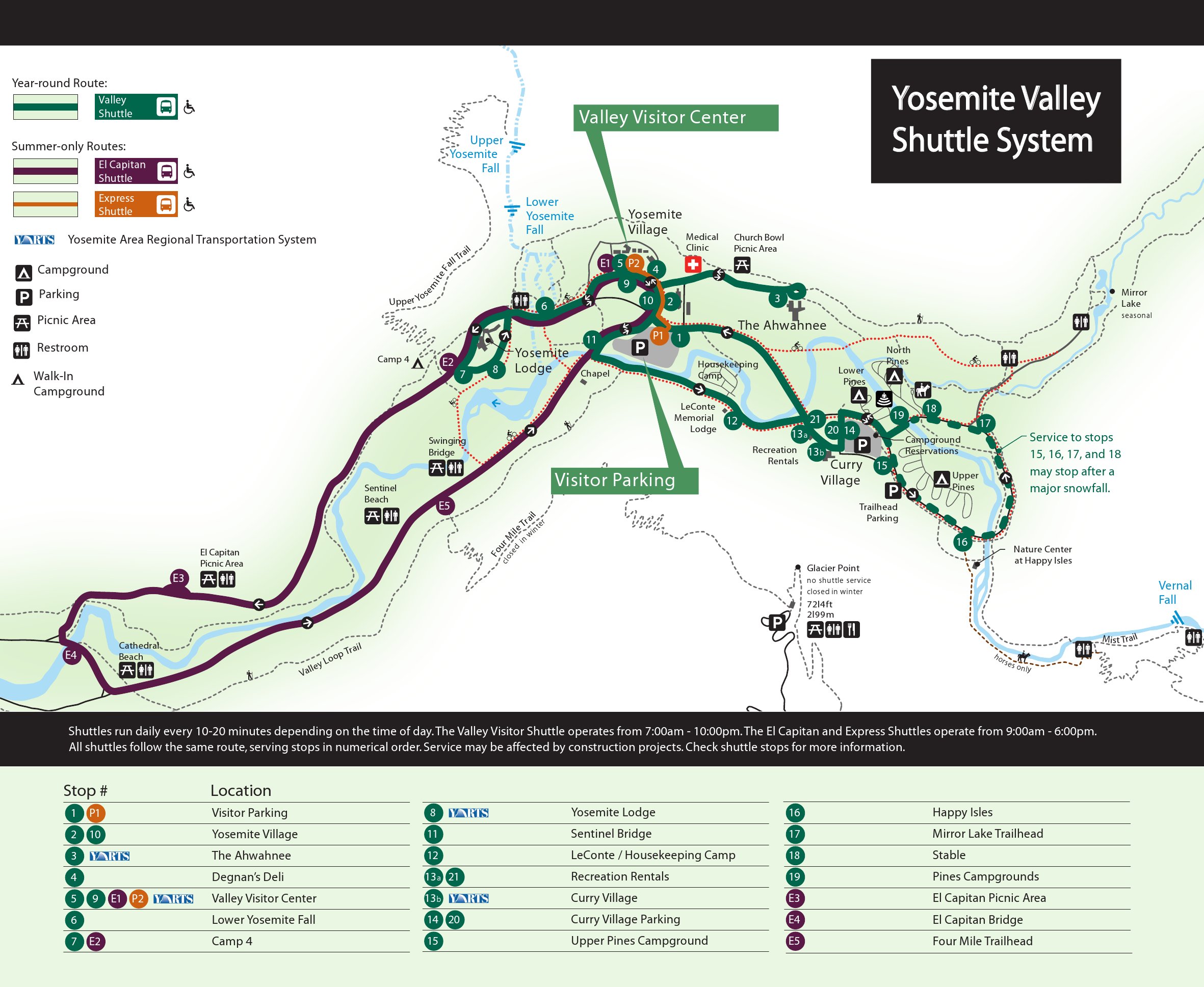 This is a Yosemite Valley shuttle bus map. This map shows the year-round route as well as the two summer-only shuttles. Click the image to view a full size JPG (500 kb) or download the PDF (350 kb).
 Here’s a Yosemite Valley parking map (150 kb), showing the various parking areas in Yosemite Valley. Expect traffic if you’re visiting in the summer or on a weekend, so arrive early and use the bus!
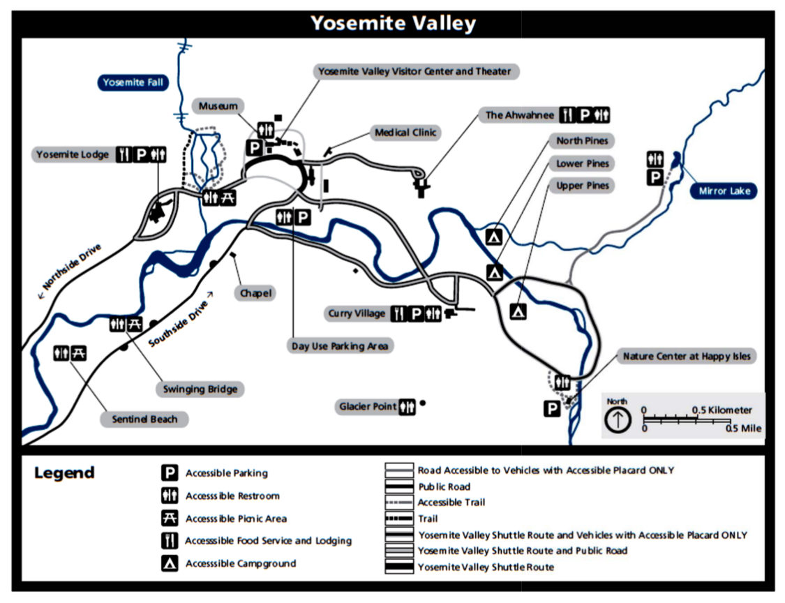 This is an accessible Yosemite Valley map (150 kb), showing the accessible parking areas and trails within Yosemite Valley (suitable for wheelchairs). You need a blue placard to park in the accessible spots.
 This Yosemite Valley cross-section (40 kb) isn’t really a map, but it’s so cool that I had to include it; it shows the width vs. the height of Yosemite Valley with north/south cross-sections in three locations.
Reference: Yosemite national park hiking trails map